Showing posts with label Sara Park. Show all posts

Friday, May 6, 2016

LHC Hiking the Lizard Peek Trail (Thursday, April 14th, 2016)

We called our friend Linda last night to see if she would want to go on a hike with us today.  We have tried in the past to find the trail to Lizard Peak, but haven't had any success.  So we have done some more investigation and we think we can find it now.  It looks like it will be a pretty rigorous hike, but it should be fun.

Linda came over to our house at 8:15 this morning, and by 8:30 we were at the trail head parking lot. The hike we are doing starts in Sara Park, just like the "Crack in the Mountain" hike that we did back on February 21st, but instead of following the wash down to the lake, it heads to the top of the highest mountain peak, called Lizard Peak.

I took a picture from the parking lot of the peak we will be hiking to.  If you look closely, you can see a tiny square on the top of the highest point.  That is a picnic table.  Strange, but true!


A zoomed in picture of the picnic table

Steve standing in the wash trying to figure out where the trail starts.  It always seems so clear when you are using the map at home.  Then you get to the actual locations and everything changes!

He thinks he has it!

Off to the left of the wash, by the trail to Lizard Peak is yellow marker 7

Off to the right is this rock and small marker.  This is the trail.
As you start up the trail to Lizard Peak, there is a 80 foot long geoglyph of a lizard.  You can see it most of the way up the trail to Lizard Peak, and hence the reason this hike is called the Lizard Peek Trail.  

The elevation in the main wash is 765 ft, we then climbed to the saddle at an elevation of 1190 ft, then to the peak with an elevation of 1370 ft.  This trail was established in 1982 by Tim O'Connor and the Leaping Lizard Tribe who hand carried the table to the top and built up the grade with army shovels.  Tim O'Connor also developed the huge rock lizard visible below.


This geoglyph is made of stones placed in the shape of a lizard

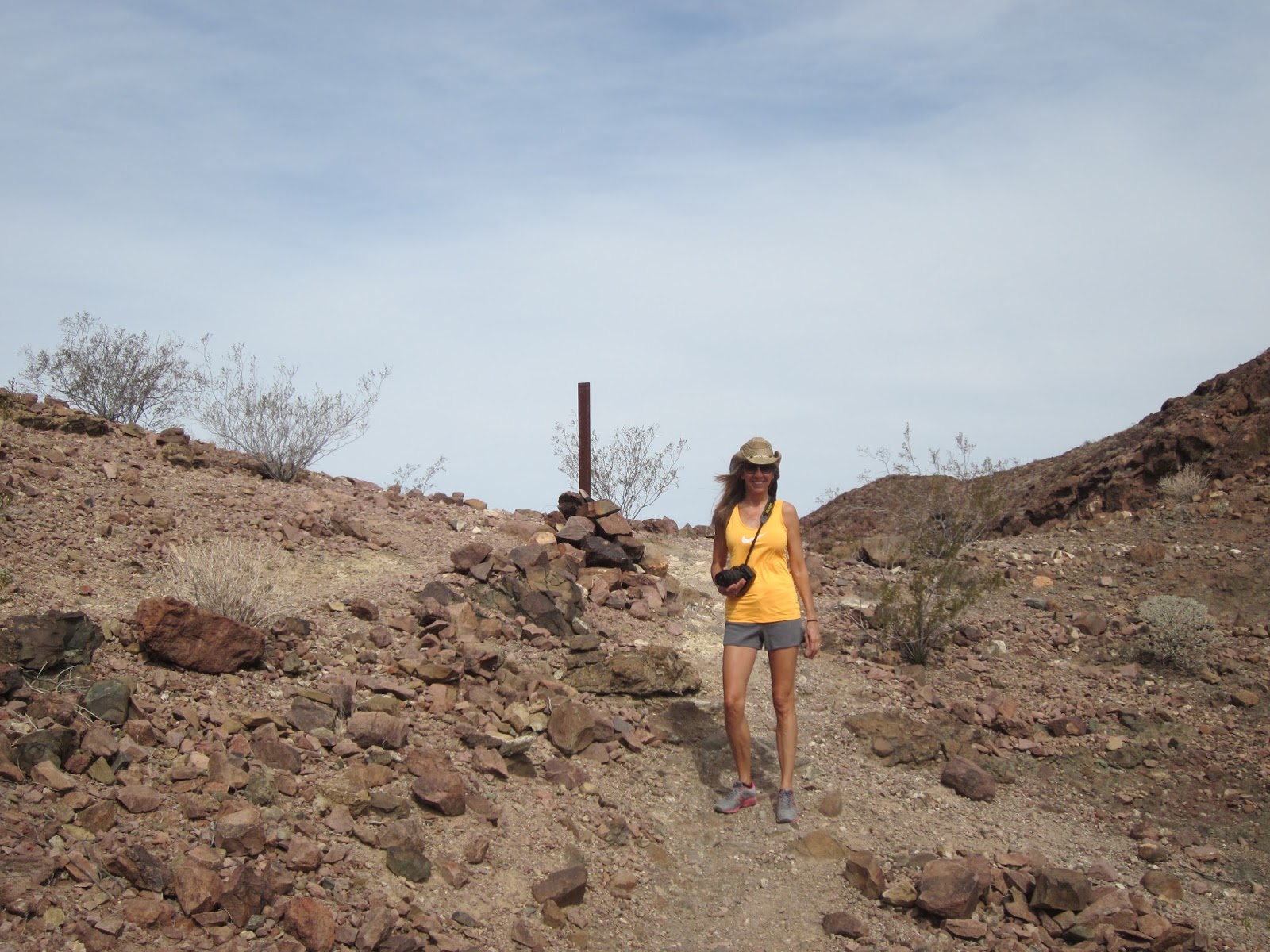
Steve and Linda on our way up.  The terrain is not bad near the bottom.
A picture of me, taking a picture of them!


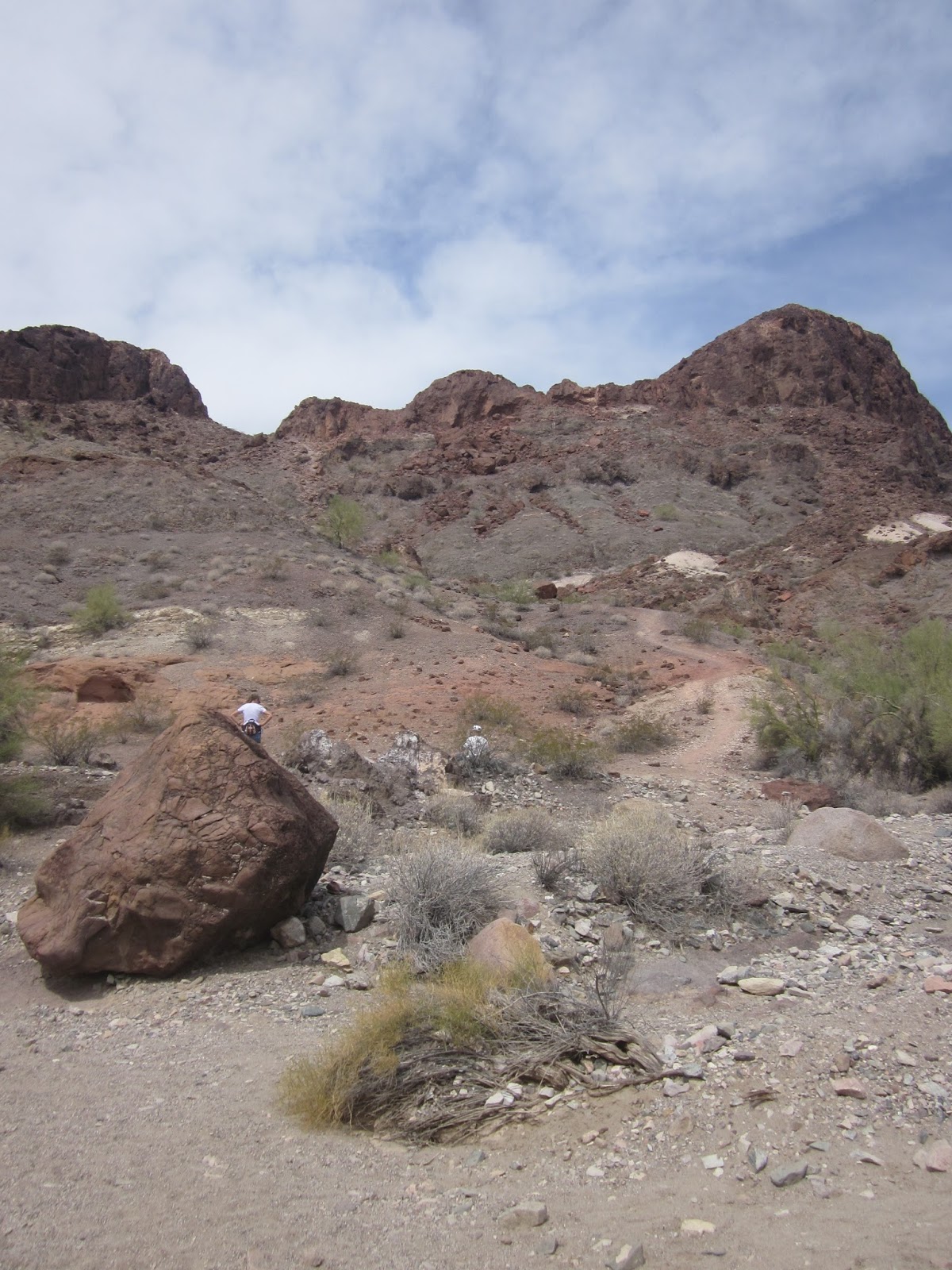
There is a trail that goes around the base of the rock peak, but we want the one that goes to the top


About two thirds of the way up the front face, we reached three ledges, one after the other.  They were difficult ledges, but I typically like that type of challenge.  They wouldn't have been a problem if my fear of heights hadn't kicked in. They weren't that hard to navigate, but below the ledges was a huge drop off that just wasn't working for me.  So I started my yoga breathing and scampered up the ledges.  Steve said I flew up them.  I really don't recall much of it!  If I had come along these ledges going down instead of up, I don't think I could have done them.  The sight of the drop-off below them would have stopped me in my tracks!

Steve coming out of the ledges


Once we got through the ledges, we hiked a bit further and then came to the saddle between the two peaks.  The view from the saddle was really pretty!

Just reaching the saddle

The view to the northwest as we stood in the saddle

The view directly west from the saddle

The saddle following the ledges is the dip on the far side of the picture
Once we took a few pictures on the saddle, we continued up to the peak, just following the terrain straight up the loose, steep slope. Again, I had another panic attack.  Steve had to assure me that there was another way down, because if I continued, I would not be able to come back down this way.  My fear of heights was really getting in the way of this great hike.

We finally made it to the top and had a 360 degree view. Totally amazing! It was fun to see the world around us from every angle. We spent about 30 minutes at the top before we started back down (from the other direction).  : )


From the top, we could see where our truck was parked.  It's the second one from the left.
Copper Canyon on the far side of the lake
Steve pulling up the computer so I could do a little work.  There was great cell coverage up there!


Before we left the top, Steve decided to do a panoramic video

Sign on the red table


There were also some really nice views as we made our way back down the other side.


I love this double arch
Steve and Linda on our way back down


We could see the lizard geoglyph from this side of the peak too

These are the switchbacks coming down the south side of the peak.  It's not nearly as steep as the north side, and no panic attack areas!!!


Steve and Linda part way down
The last pictures serve no other purpose than to help us find the southern route to Lizard Peak again.

When you see the .6 mile marker, go a little further (where Steve is), then look for the big rock and the red arches off to the right.

When you see this large boulder in the wash, look to the right.  You should be see a red sand "arch", and the trail going up to the saddle.

Another view of the red sand "arch" (left) and the trail heading up (right)

A close up view of the red sand arches
At the beginning of the southern trail, you will see this arrow (if it's still there)
We had a nice snack of grapes and fig newtons at the red picnic table, and had some more when we got back to the truck.


After some great exercise during the day, we treated ourselves to yummy pork chops on the grill for dinner, in the great atmosphere of our own back yard.  


Monday, February 29, 2016

Playing in Paradise and Desert Big Horns (Saturday, February 21st, 2016)

I often talk about how much there is to do and see in Lake Havasu City, so I thought I would share a few of our adventures these last few weeks.  It is almost a little unfair because of the amazing weather we have been having, so I am leaving out boating, jet skiing, paddle boarding, etc. to keep it a little bit more realistic of what a person might do in February in a typical year.

We had one windy day while we were down here, so we met up with Steve's brother Dennis and his wife Cyndi at Rotary Park, which is on the mainland side of the channel at the south end.  Dennis and Steve both brought their stunt kites (two-string) for a kite flying day.  We started out in the baseball fields, but decided that the wind was too gusty, so we moved down onto the beach.  The only problem with kite flying on the beach is that when the kite goes down, it's likely to get wet, and then muddy, but that was a risk we were willing to take.  I actually prefer flying on the beach because I just love the surroundings so much more.

Steve, Dennis and Cyndi.  Even though it was windy, it was still nice and warm!
Later in the day, we decided to stop by our friends house to check on their dog.  They have been out of town for a few days, and although they have a feeder and water for their dog, we were afraid she might still get lonesome, so off we went to see her.  When we got there, she was so excited to see us, so we played ball for a while and just loved up on her.  But within about 20 minutes, she had played enough, and went up on the porch and was done with us.  So cute!  As we were leaving their house, we noticed a roadrunner on the roof of one of the neighbor houses.  We thought this was odd, because we didn't realize that roadrunners could fly.


So when we got home, I did some research, and to our surprise, roadrunners can fly!  My internet research lead me to this beautiful picture of a roadrunner in flight.  Obviously, this is not my own picture, and I appreciate that the internet can help by providing such a beautiful picture!


Our next adventure was remote control float planes.  Steve's brother Dennis is very into radio control planes, and on Tuesday mornings the RC plane club of Lake Havasu was doing a float plane fly out at Rotary Park, so Steve and I decided to go down and watch them for awhile.  As we were waiting for them to set up, we got to enjoy an incredible sunrise!


Looking across Thompson Bay toward California

Looking back toward the Bridge Water Channel at the San Bernardino Mountains

Looking straight across Thompson Bay to the Nautical Inn

Dennis and Steve with Dennis' float plane

Bringing in the plane rescue boat and hoping it's not needed...it was!


We also discovered pickleball while we were down here this time.  It's probably been around for years, but we didn't know there was a club here.  They set up three nets on the basketball courts by the dog park on the island.  They play everyday except for Monday and Wednesday from 8:30 am to noon.  There are also a few indoor locations where they play, but half the reason we play is to be outside, so the outside courts caught our eye.


They only had two nets set up at this point, but there are usually three
Steve and I went down and played with the club one day, and they invited us back to play in a round robin tournament that they were holding later in the week.  So we signed up for the round-robin, and went back later and played.  The round-robin was men first from 8:15 to 10:15, so I dropped Steve off and went to the gym, then came back to the island for my turn.  The women played from 10:30 to 12:30.  It was the perfect thing for Steve and I because almost everyone that signed up was at about our level, and we got to know a lot of new people.  This is definitely something we will start doing while we are down here.  We're not sure if they play in the summer or not, but we'll get it figured out.  

Our next big February adventure was a hike at Sara Park.  Sara Park is located on the south side of town, and is where we went for the fireworks show earlier this trip (see our post "Pyros in Paradise, Feb 12th and 13th). We parked back by the rodeo grounds and took the "Crack in the Mountain" trail. For this hike, you follow the yellow markers, and it will take you all the way down to the lake. Most of it is a normal desert hike, but it has an area about half way down that has some really fun narrows to hike through. 

When we arrived at Sara Park, we realized that there was a mountain bike race happening, and we were not able to park in the normal parking lot.  So we parked down the road and made our way over to the trail.


The race course was on the ridge above our trail for part of the race

Approaching the narrows


I had a bandana on to protect my chest from the sun.  It burns easy!

There used to be a ladder here, but now it's a rope and a Carabineer
My first time repelling.  I'm glad it wasn't too far!


We're almost to the lake.  We are glad as it is hot!


And then after a brief stop at the lake, we started back into the desert, but this time we took the blue trail up and over, instead of through the narrows to take in some different scenery.


You can see our trail from the lake
And then we ran across this family of desert big horns.  It appeared to be a mom, two yearlings and a baby.  Although we really don't know!  They weren't afraid of us at all.  They must see a lot of hikers.


A yearling and the baby

Yearlings and baby

Mama and baby


 What an incredible reward after a nice desert hike!  Everytime we hike in the desert we are amazed at the beauty it holds for us to see.

The next day we caught up with our friends Tim and Cheryl and Brian and Kathy for a trip up main street for the Winterfest Street Fair.  Vendors come in from all over the area and set up a huge craft show for all of us to browse and enjoy.  There are food vendors available, but since it's on Main Street, there are also restaurants that you can duck into for some food or drinks. 


Kiln fired wine bottles!  They're Awesome!

Metal yard art.  I LOVE it!
Cheryl and Kathy enjoying a desert martini (a beer with an olive in it)

Check out this yummy looking food stand!


I loved this sign that was on display.  It truly describes my life!


And here we are ducking into the No Name Public House.  It's new, and I thought it looked sketch, but once you are inside, it is a warm friendly neighborhood bar

It's a boat car!  You can drive it on the road or the lake!
Winterfest was a great end to a fabulous two weeks in Lake Havasu City.  Now we must once again say goodbye to our home away from home, and start thinking about moving on.